Lease Images
Site plans, architectural drawings, and aerial photographs for lease documents and tenant packs. Click any image to open full size. PDFs and ZIPs open or download directly.
Review five redesigned camp map concepts →Site Plans
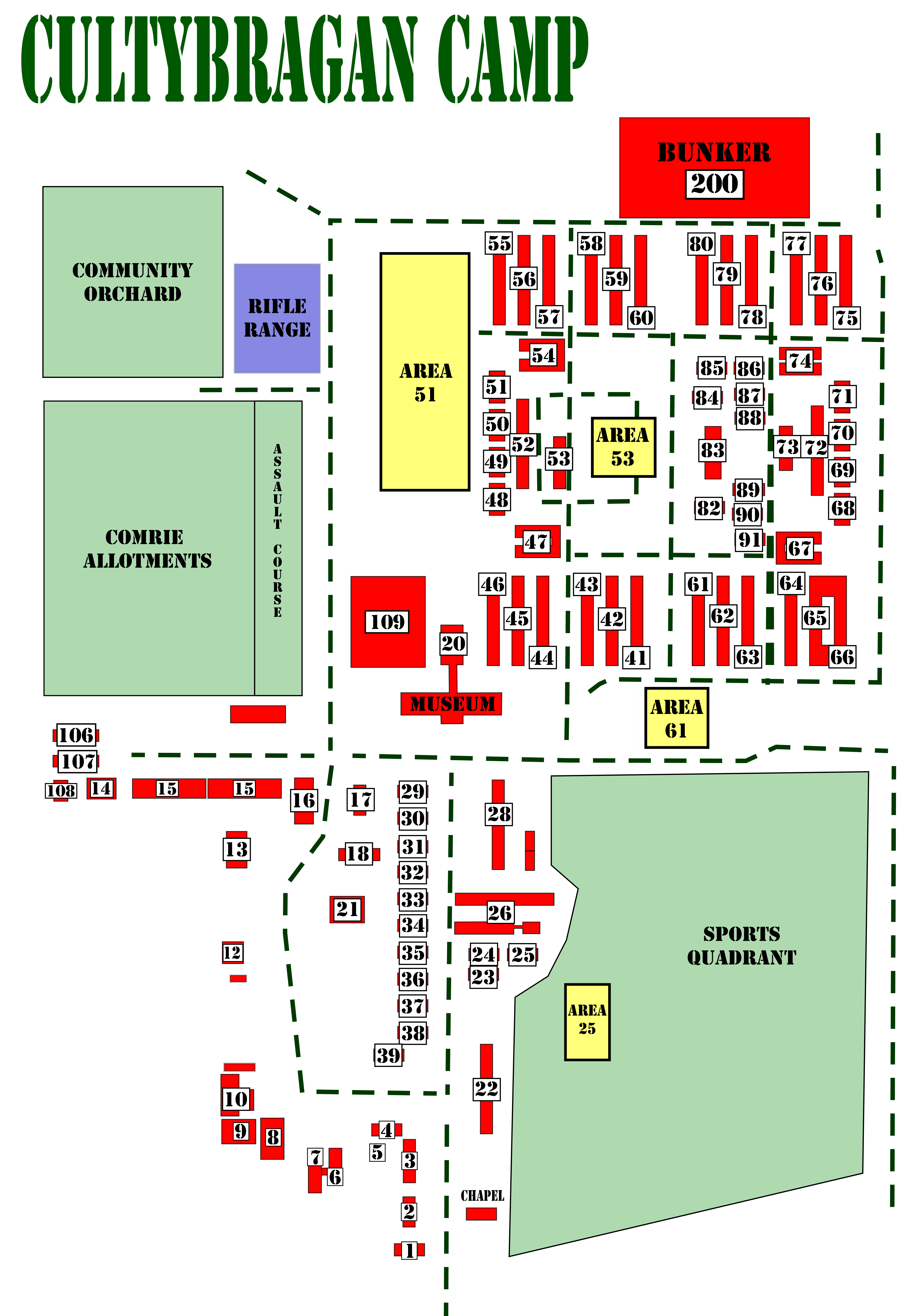
Site Plan — Buildings with Numbers
Overhead site plan with all building footprints numbered. Best reference for identifying a specific hut in lease documents.
Open full size ↗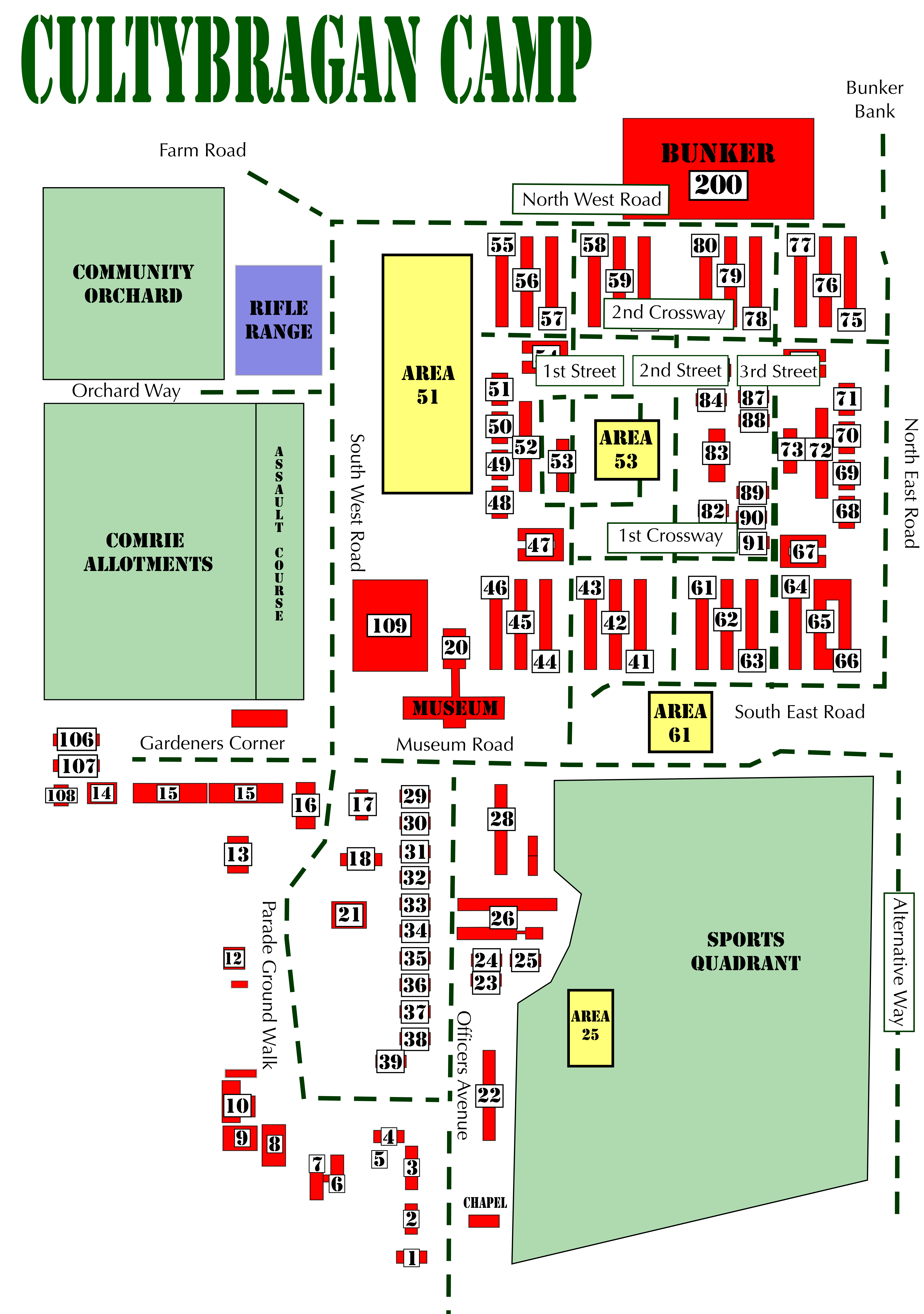
Site Plan — All Data
Full annotated plan showing buildings, road network, and named areas. Most complete single reference.
Open full size ↗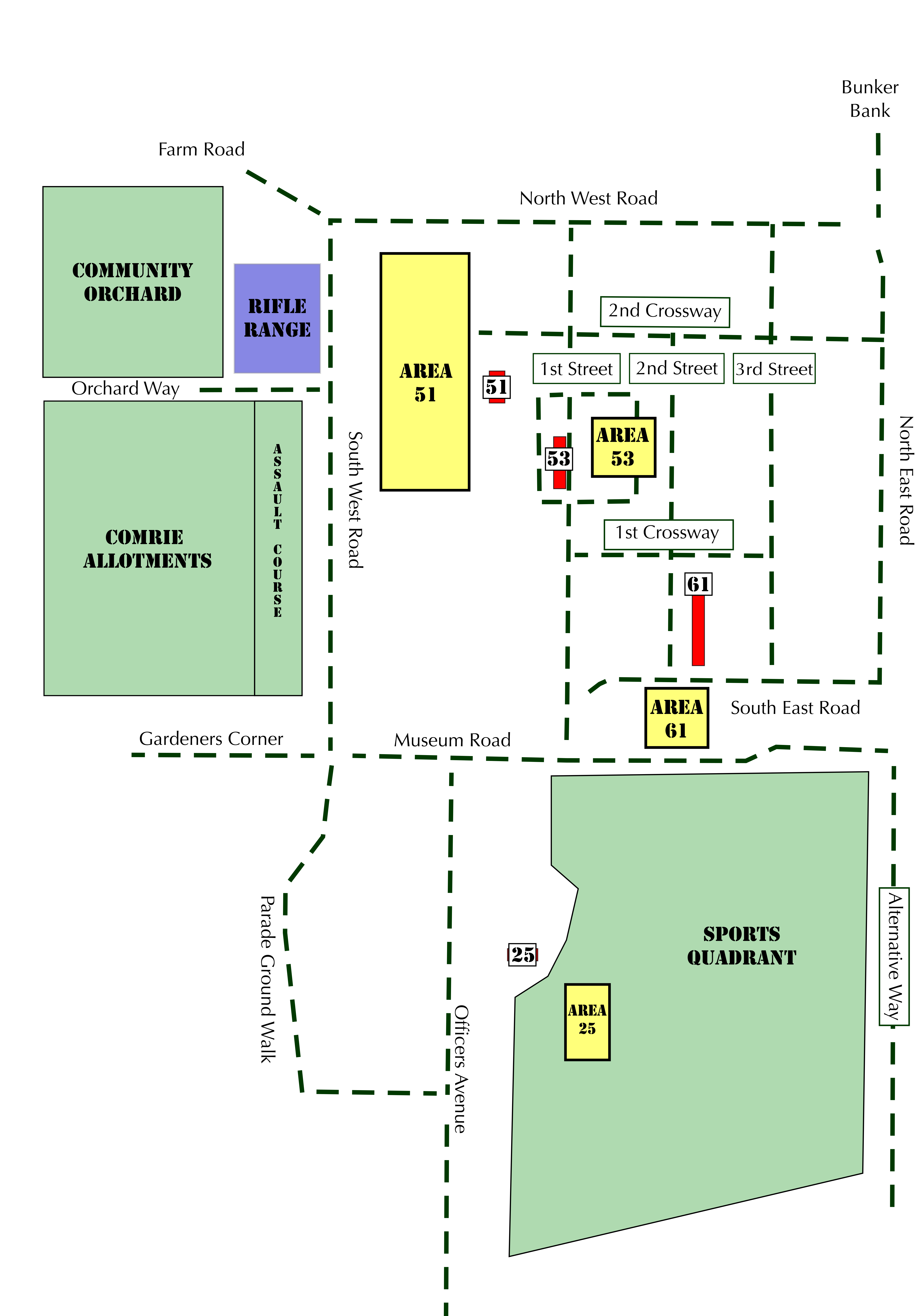
Site Plan — Areas and Road Names
Named roads and zones across the camp. Useful for directing tenants or contractors.
Open full size ↗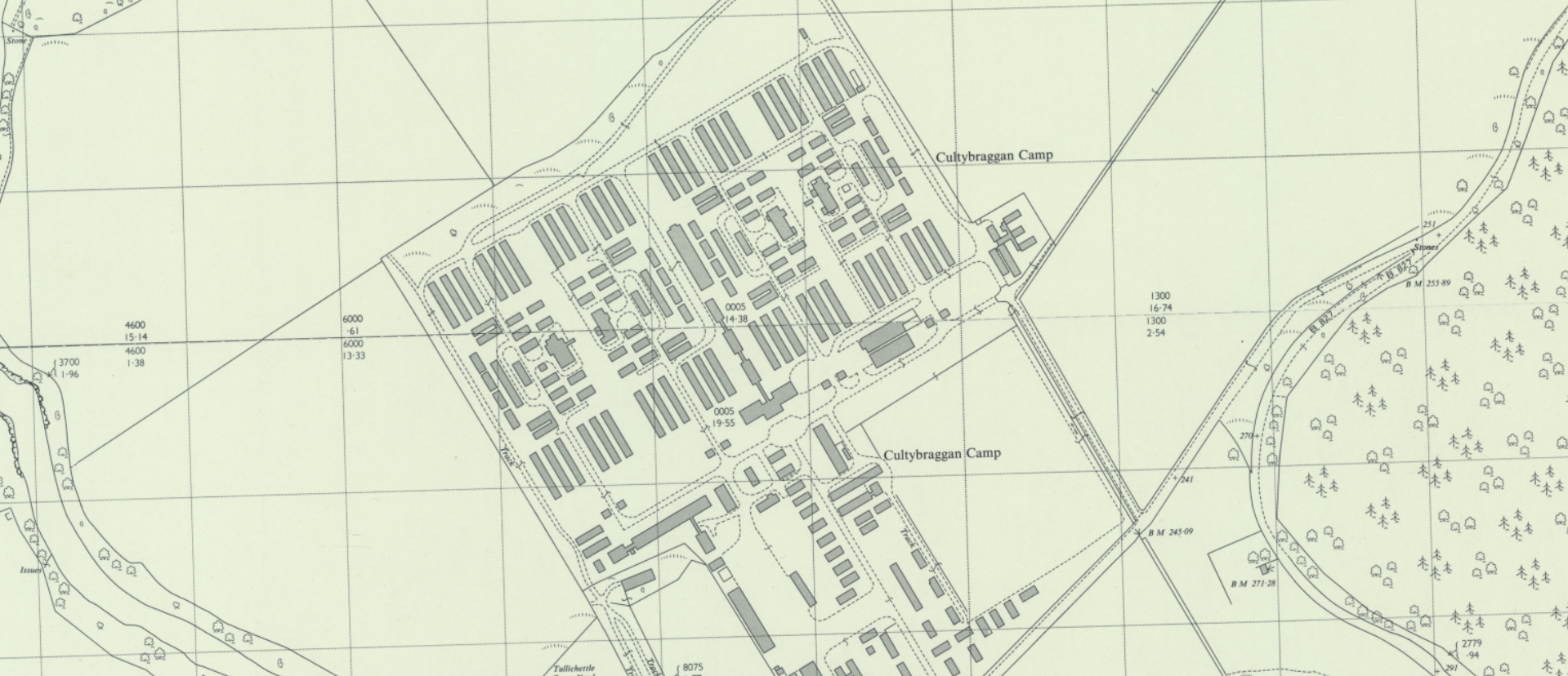
Historic Camp Plan (1948)
Original 1948 plan of the camp showing the full layout as built. Useful for heritage context.
Open full size ↗Camp Layout 2021 (PDF)
Updated camp layout plan from 2021 showing current building use and road layout.
Open full size ↗Site Plan with Property Numbers (PDF)
Formal site plan keyed to property numbers. Useful for lease schedule references.
Open full size ↗Architectural Drawings
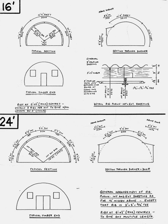
Nissen Hut Drawing — Exterior
Architectural drawing of a standard Nissen hut exterior. Shows the characteristic semi-circular corrugated iron profile.
Open full size ↗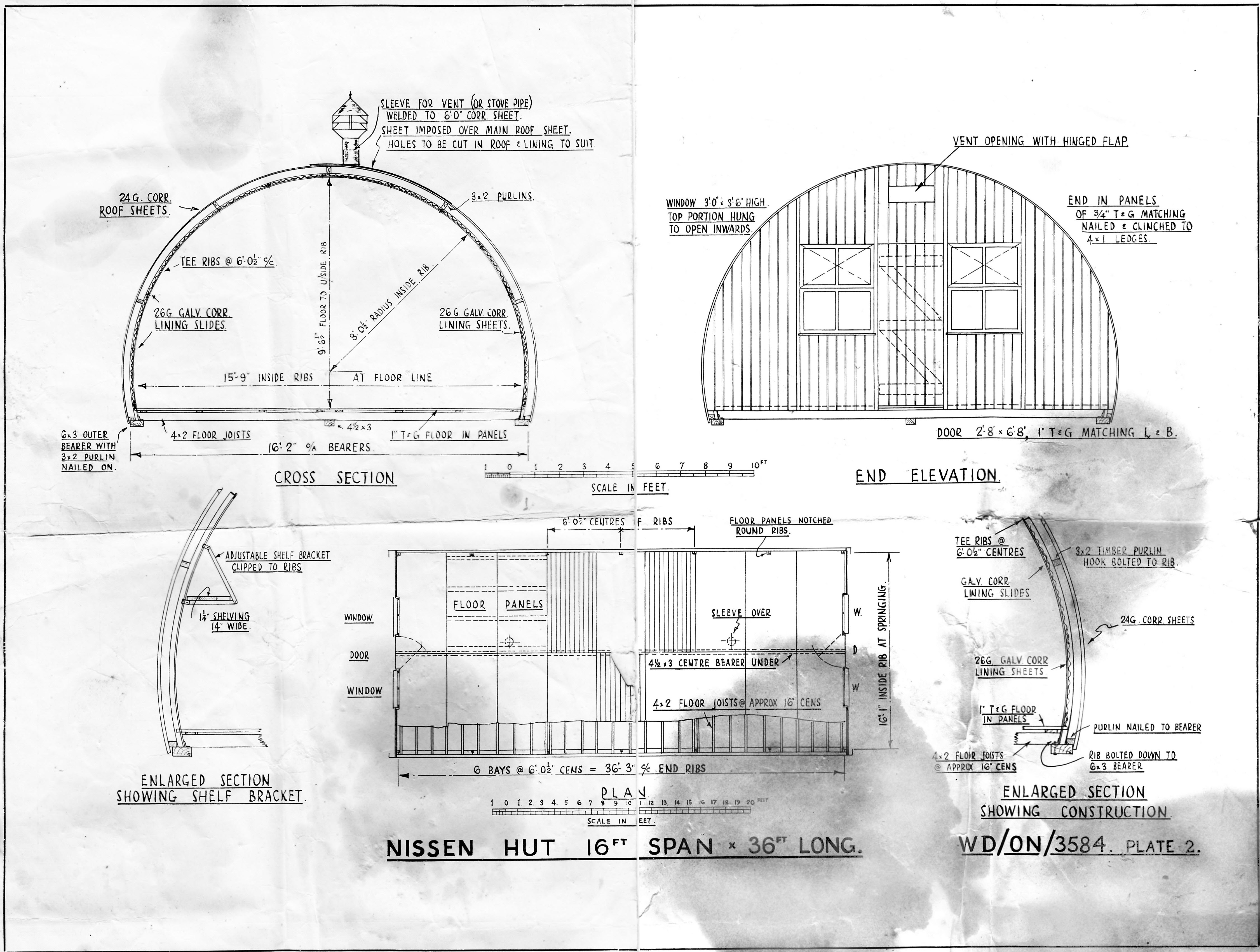
Nissen Hut Drawing — Detailed
Detailed architectural drawing showing hut construction and dimensions.
Open full size ↗Self-Catering Unit Drawings (ZIP)
Full set of architectural drawings for the self-catering conversion units (huts 29–39). Includes floor plans, sections, and elevations as existing and proposed.
Open full size ↗Camp Services Plans (ZIP)
Full set of services layout plans (electrical, water, drainage, heating) across the camp as of March 2025.
Open full size ↗Aerial Photographs
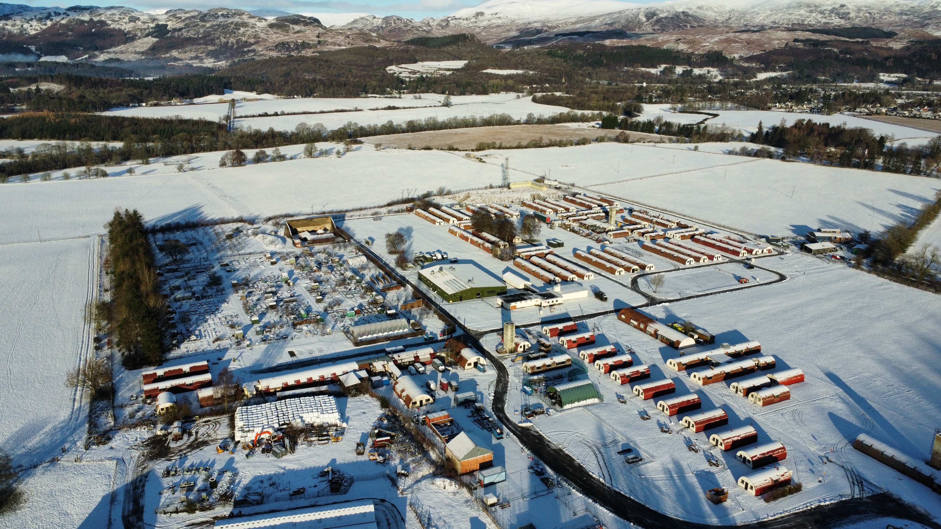
Drone — Full Camp Overview
High-resolution drone shot showing all hut rows from above. Best single image for orienting a prospective tenant.
Photo: Bob Kerr (used with permission)
Open full size ↗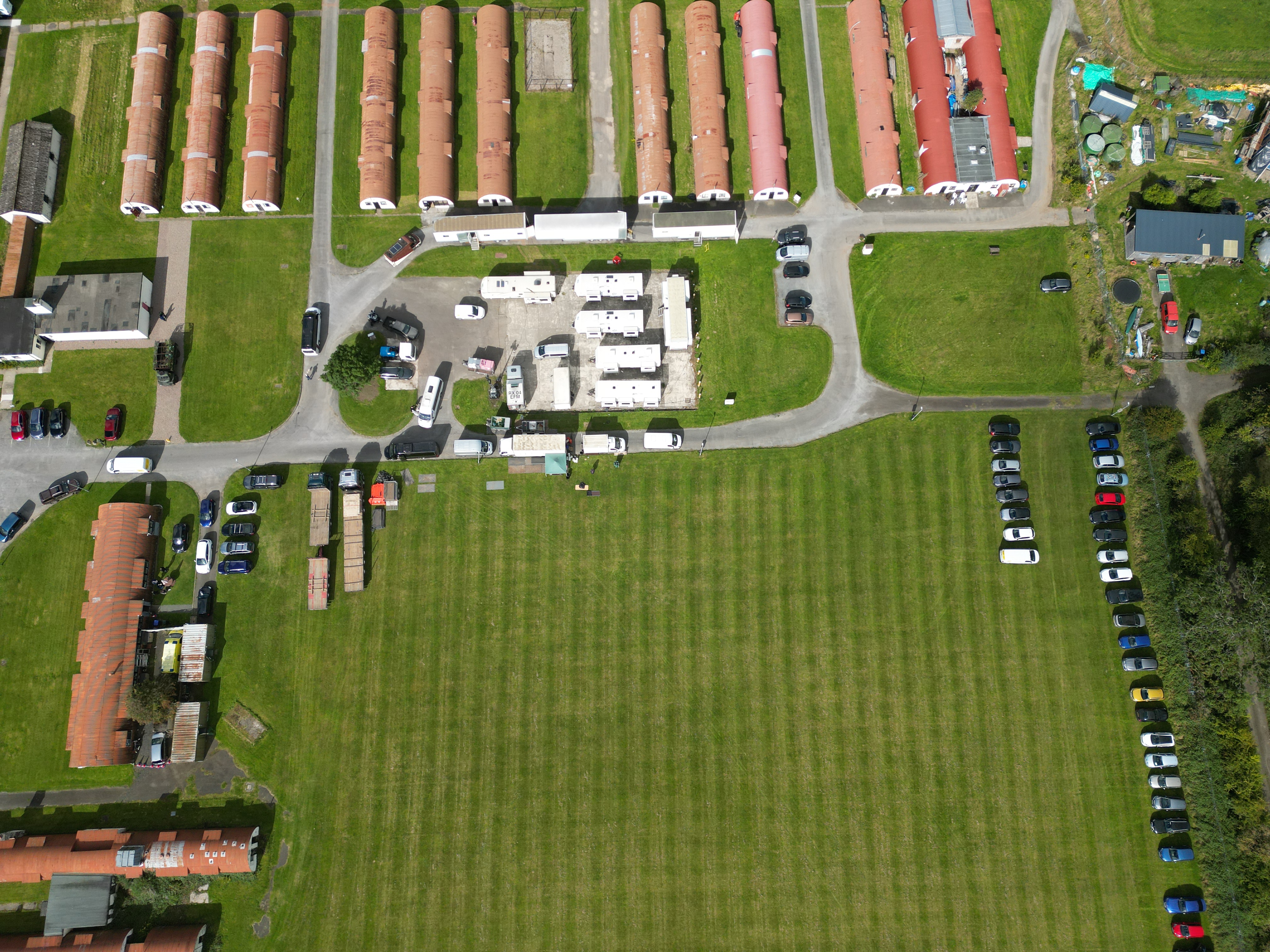
Drone — Camp (Summer)
Overhead drone shot in summer conditions showing hut layout and road network.
Photo: Bob Kerr (used with permission)
Open full size ↗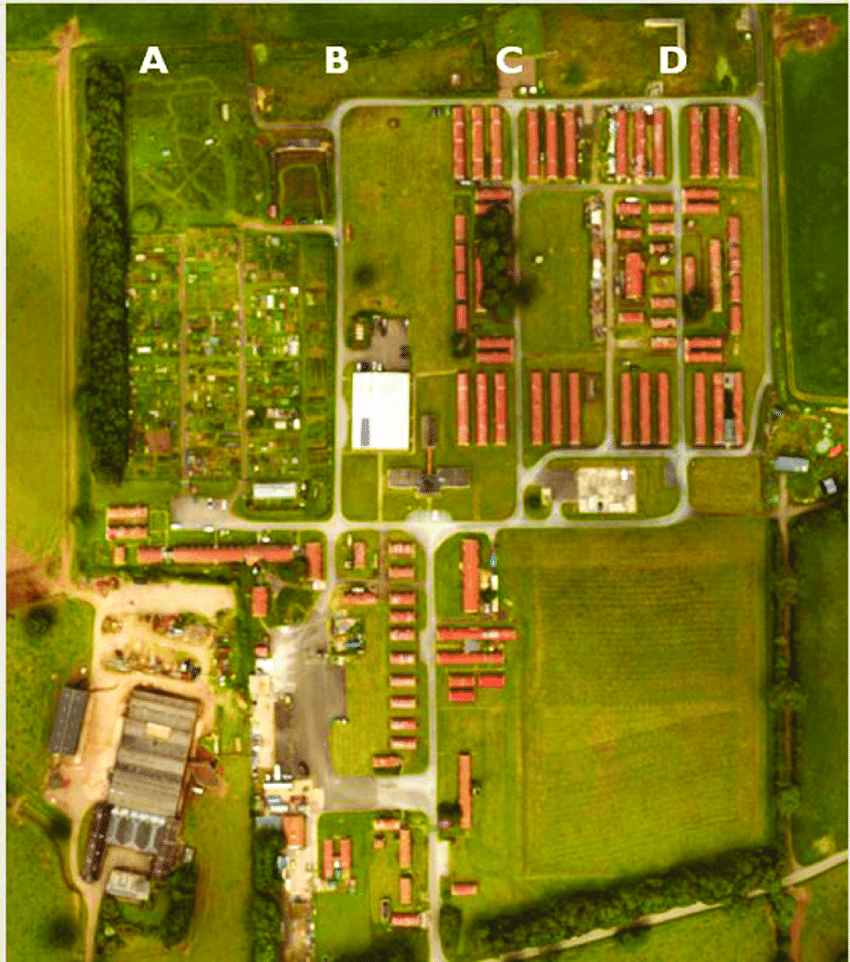
Aerial — Full Site
Oblique aerial photograph showing the full extent of the site and surrounding landscape.
Photo: Susan (used with permission)
Open full size ↗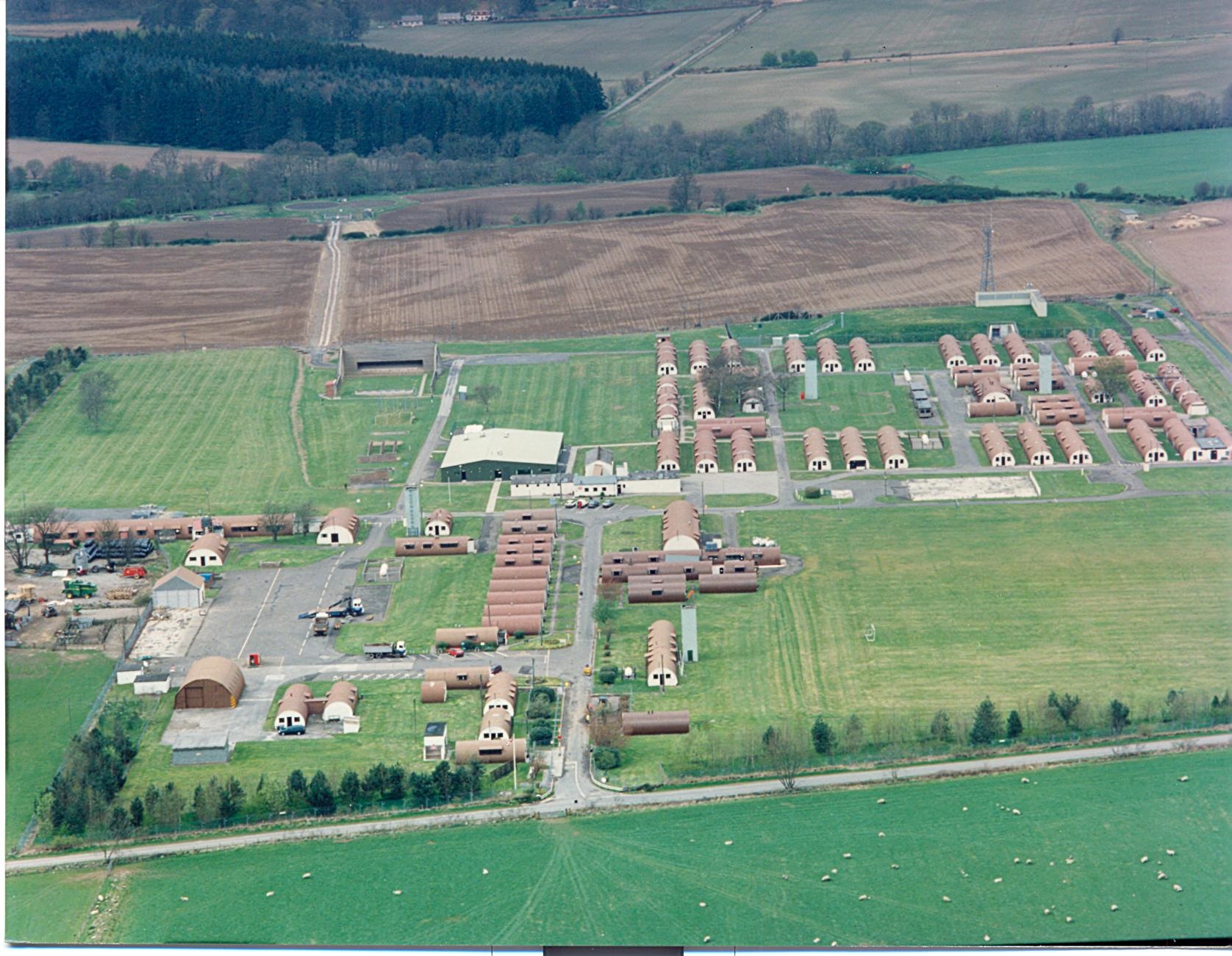
Aerial — Overhead
Directly overhead aerial showing the hut grid layout clearly.
Photo: Susan (used with permission)
Open full size ↗Land Ownership & Title Documents
CDT North-East Boundary — House Plot Title Plan (PDF)
CDT-produced title plan (January 2012, Drawing CDT/Culty/House Plot/TP Rev B) showing the north-east corner of the camp at 1:250 and 1:1250 scales. Identifies the CDT Munitions Dump to the north-east, the CDT-owned Armoury, and the exact ownership boundary (ditch/stream and post-and-wire fence line). OS coordinates are given for all boundary corners. The access track to Cultybraggan Farm lands is also labelled.
Best available map for the north-east boundary between CDT and Cultybraggan Farm. The ditch with stream marks the CDT ownership boundary on the south-east side; the post-and-wire fence marks it on the south side.
Open full size ↗Cultybraggan Farm — Sale Particulars with Field Map (PDF)
Galbraith estate agent particulars for the February 2022 sale of Cultybraggan Farm (235.81 ha). Page 12 contains the definitive field map showing all farm land in red — the CDT camp appears as a white void, making the farm/camp boundary immediately legible. Includes a full field schedule (pages 13) with hectares and land use for all 40 numbered fields.
Best available document for understanding the boundary between CDT and the farm. Page 9 confirms CDT retains two outlying areas excluded from the farm sale: the old sewage works (north of the farm steading) and the former ammunition store to the north-east of the camp.
Open full size ↗Land Register Title Plan — PTH19885 (PDF)
Official Registers of Scotland title plan for CDT's registered title PTH19885, updated November 2020. Pink shading = CDT's full legal ownership: the main camp rectangle plus the riverside meadow to the south along the Earn. The outer edge of the pink area is the legal boundary.
Does not label neighbouring owners by name. For the Cultybraggan Farm boundary specifically, see the RoS ScotLIS portal or the agreed-boundary correspondence.
Open full size ↗Agricultural Parcel Map — 651/0010 (PDF)
Scottish Government Rural Payments parcel location map for CDT's agricultural holding (location code 651/0010), dated June 2015. Yellow boundary shows the 18.8 ha field parcel (LPID NN/76645/19318) registered for the Basic Payment Scheme — roughly the land south and east of the camp along the river.
Shows the agricultural parcel boundary only, not the full legal title. The parcel sits within CDT's title PTH19885.
Open full size ↗RPID Parcel Review Letter — 651/0010 (PDF)
Scottish Government RPID inspection letter (April 2015) confirming the parcel boundary following an on-site review. Identifies ineligible features: road (0.07 ha), bracken (0.55 ha), scrub (0.04 ha). Net eligible area 18.13 ha.
Administration document only — no boundary map. Useful if there is ever a dispute with RPID over the registered parcel area.
Open full size ↗